|
StormTours.com took out a couple customers on a 1 day tour to Stuart, NE on June 9, 2003 and had great success. Leaving Plymouth, MN at 6 a.m. Monday morning we headed southwest targeting O'Neill, NE. Along the way we stopped at KOOL 98, an Oldies station in Mitchell, SD where our friend and on-air personality Kory Hartman allowed us to use the station's high speed Internet access for some last minute data. After viewing the latest surface observations and satellite imagery, we decided that O'Neill was still a good target, so we headed south out of Mitchell. While on the way down, the Storm Prediction center issued a tornado watch box for our area. We continued south to O'Neill where we were forced to stop at a library for data since our Internet connectivity through cell phone was unsuccessful. Bill Doms got there first and got all of the data up. By the time Peggy, Mel, myself and our guests Erik and Mike got there Bill had all the data ready to show us. We all agreed that things looked good just a bit to our north. Cumulus were begining to pop just northwest of O'Neill. Dave Floyd, the Warning Coordination Meteorologist from Goodland, KS was also chasing in the area. He talked to him on the phone and he along with some other tour groups in the area were all in agreement to head north to the cumulus field.
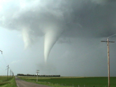
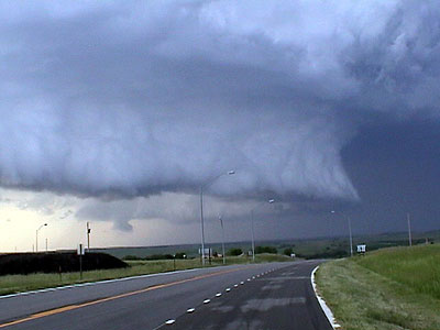
After the tornado, we went north to the next tornado warned storm. We only found this gorgeous structure of what I believe was the old meso getting cut in by the RFD.
View the complete video footage of the tornado from wall cloud to dissipation. This video clip is in AVI format and is compressed using the DivX codec. If you do not have Windows Media Player versions 7 or 9 and the DivX codec installed, I do not recommend trying to view this file. You can download Media Player and DivX from download.com if you need to. The file is over 17 meg, so it is recommended you only try to view this if you have a high speed, broadband connection.
|
 On our way north, just west of Spencer, NE along the NE/SD line we noticed an interesting 'feature' with intense vertical motion and condensing scud. This was a very small updraft which was amazing to watch with the amount of updraft strength it had at it's updraft base, but the cell itself was pathetic, with no rain core or structure other than for the updraft base. Mel was particularly interested in this and I wanted to ignore it. But we stuck with it since I was overruled. I'm so glad I was!
 After watching this feature and following it slowly for quite a while, the updraft got behind two seperate cells just to the east which developed. These cells processed going through backbuilding and merging stages. The two cells to the east became one and this updraft we watched also merged with these two cells. Together it became one powerful supercell. The updraft we watched for such a long time eventually turned into a wall cloud and updraft base for the main updraft, eventually producing the tornado! It was amazing to watch this evolution.
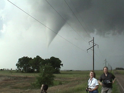
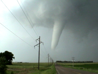
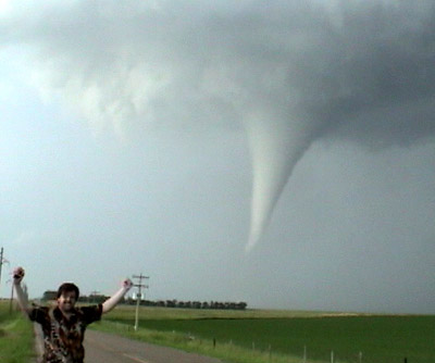
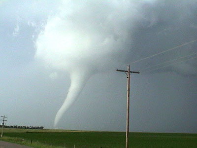
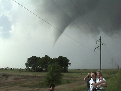 Just as we could visually watch the two cells to our east merge into one, Rob Koch from KSTP in Minneapolis called us and confirmed the cells merged. He also stated that the inflow/outflow couplet was "amazing". As the storms merged our rotation under the updraft intensified, a funnel dropped and eventually became the tornado... about 5 miles north of Stuart, NE. Touchdown was approximately 7:15 p.m.