Severe Weather
Forecast Discussion
This discussion is NOT intended for
navigational purpose, but rather to help spotters better prepare for a
potential severe weather event.
Summary
Forecasts are done using model guidance in
the form of maps and forecast soundings available at http://www.f5data.com/.
Discussion
-------------------------------------------------------------
I'm probably going to fail miserably with this forecast because
I'm going so far against the SPC's forecast, so I should preface this by
suggesting you also consult the SPC forecast for today.
-------------------------------------------------------------
Wednesday's setup looks almost completely like a cold-core
low setup. I don't see much reason to believe traditional severe storm
parameters will work well for forecasting on Wednesday, primarily due to such a
lack of deep moisture in the warm sector ahead of the cold front.
However, when applying the teachings of Jon Davies, one could
see a small area of severe storms and non-supercellular tornadoes forming
in Iowa, particularly in North-Central and Eastern Iowa in the early afternoon
hours. Keep in mind that in this setup, Davies says that it is quite possible to
have tornadoes out of low-topped thunderstorms which do not appear severe on
radar, and do not have mesocyclones. In some cases these tornadoes form from
cells barely visible on radar. These are more of a landspout type tornado, which
are typically weak however, occasionally do produce an F2 or F3 if enough storm
relative helicity and deep layer shear can get involved. At this time it does
not appear as if any tornadoes (if they do form) would be of any significant
size. However, Wednesday's setup does indicate 30-40 knots of 6km vector shear
which may be sufficient for some of these cells to possess supercellular
characteristics.
Since I'm using Jon Davies name and supposedly applying his
tactics here, I should refer you to his paper regarding the topic, and suggest
that you read his findings yourself rather than taking my interpretation of it
for face value... just in case I'm mis-representing his work.
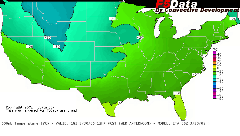
First off, lets look at the mid-day cold core low setup for
north-central Iowa.
500mb closed low, moving northeast:
500mblow.png
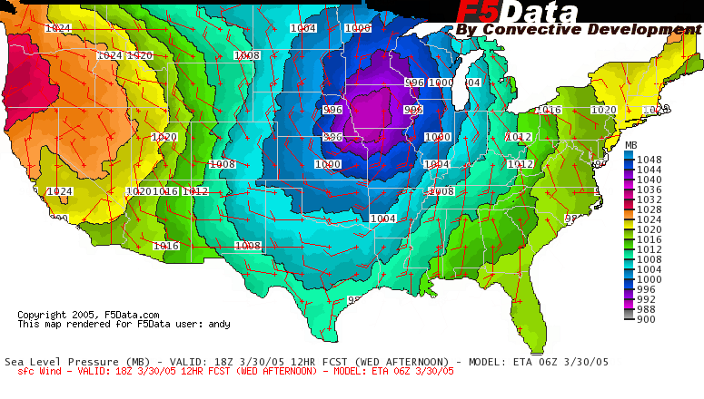
Surface low and triple point within 200 miles of the 500mb low:
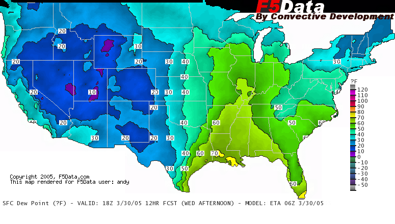
sfc.pngSurface dew points in the low 50s in north-central Iowa:
sfcdew.png
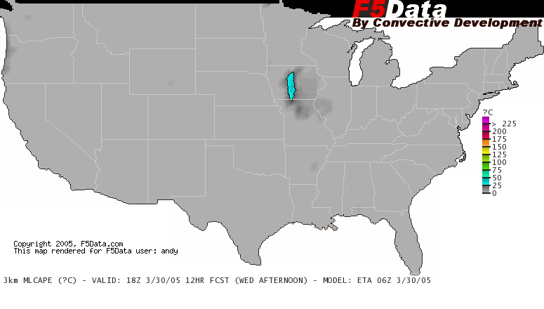
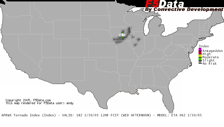
Given this information, I would say much of Iowa should keep an
eye out for the placement of potentially a tight cluster of severe storms and
perhaps tornadoes in the early afternoon. Currently I'm targeting Webster City,
IA as the epicenter for greatest risk.
In the late afternoon the cold core low severe/tornado threat
diminishes as the dry intrusion gets choked off, and the low and triple point
become farther displaced ahead of the mid level low. This will be the transition
from the unusual cold core low setup to the more typical, widely accepted method
of forecasting for severe storms.
Later in the afternoon the focus for severe weather may be along
the draping cold front from the low in Northeast Iowa down the Mississippi River
to Arkansas. Just head of and along this boundary a SLIGHT risk for severe
weather may exist. I know the Storm Prediction Center has a large MODERATE risk
out for this area, but I have a hard time believing that will verify given the
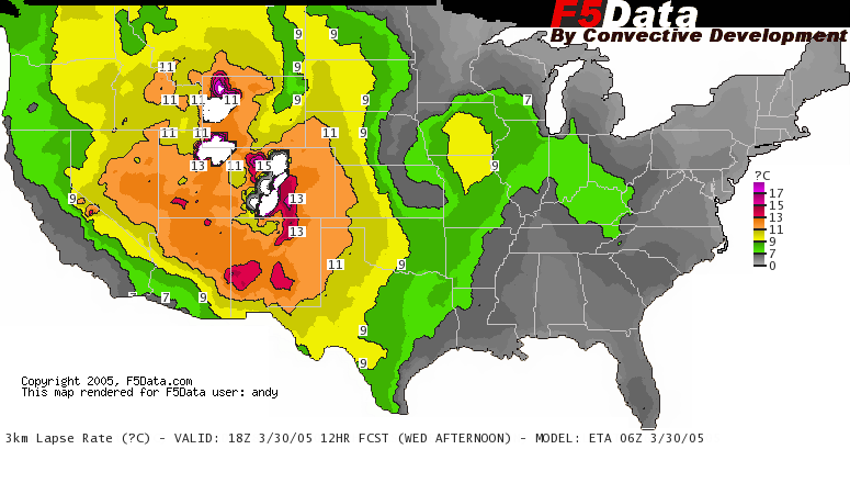
minimal moisture depth. At 850mb the dew points will be 5-8 degrees C at best.
The best deep moisture will be pooling along and just ahead of the surface
boundary. It's speed and orientation will likely mean primarily linear severe
thunderstorms with a minimal tornado risk in this area. Primary threat would be
high winds and large hail.
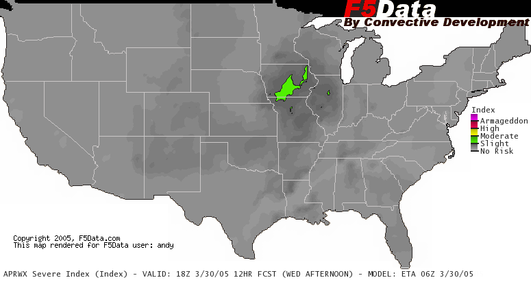
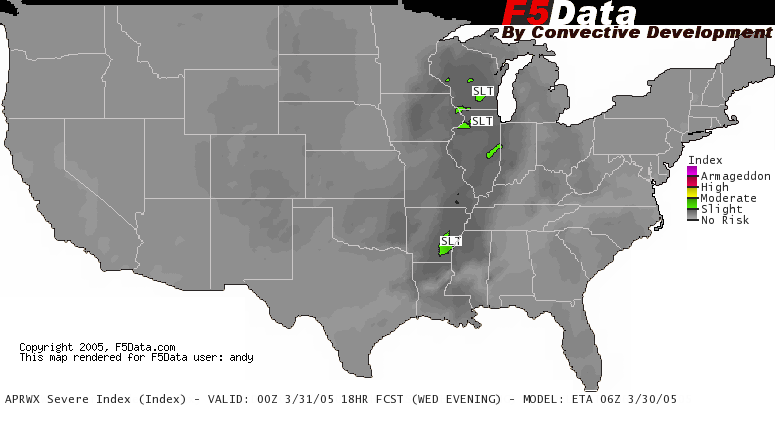
Therefore, I have to go with a slight risk for severe storms in
the late afternoon from Southern Wisconsin and Eastern Iowa into all of
Illinois, Southeast Missouri and Eastern and Southern Arkansas.
A smaller area of greater severe potential may be embedded in
this region in the late afternoon where the deep moisture is maximized and shear
is better. This would likely set up in or near East-Central or Southeast
Arkansas. Therefore, I have a secondary severe weather target of De Witt, AR in
the late afternoon.
Live, operational computer model graphics, forecast
soundings and more [F5Data] are available at:
http://www.f5data.com/
- This forecast is copyright © 2005 Andrew Revering and may not be
reproduced without copyright credit.
- The entire email may be
forwarded providing the entire email remains in tact.
- Current known circulation:
1128
- To subscribe to this list
click
here. Do not click this if you are already receiving this
email directly from me!
- To unsubscribe from this list
click
here. Do not click this if you are getting the emails
through a list such as mn-chase, f5data or
wx-forecast. 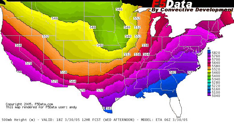