|
At 18z, the low should be near Pierre with some mid level subsidence and capping in place. East of the low across Eastern SD, it should be pretty clear. The mid level subsidence and capping should help to hold off cloud formation for a while. This is excellent as it should help to prepare the atmosphere in Eastern SD ahead of the huge low.
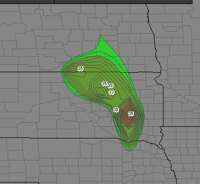
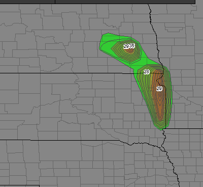
My target is Artesian, SD (Just NNE of Mitchell) in Sanborn, County for initiation between 2-3 p.m. Storms should race off to the NE, tracking through towns like De Smet, Hayti, Watertown, Milbank, Ortonville, Morris and Alexandria before starting to lose tornadic characteristics quickly after sunset. I think a long-lived tornadic supercell may indeed be likely, and chasers are probably going to be chasing well behind a damaging tornadic supercell and finding nothing but debris in their path. My advice is to plan ahead, stay ahead of the storm, and perhaps to itĺs east. If you fall behind, donĺt follow directly behind it because any damage in your way will likely set you back with no chance of catching up. Parallel the storm track to the rightů.stay in itĺs inflow side.
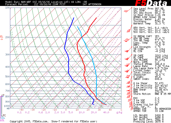
Some other notes on the setup over Artesian:
See the sounding for Artesian, SD:
|